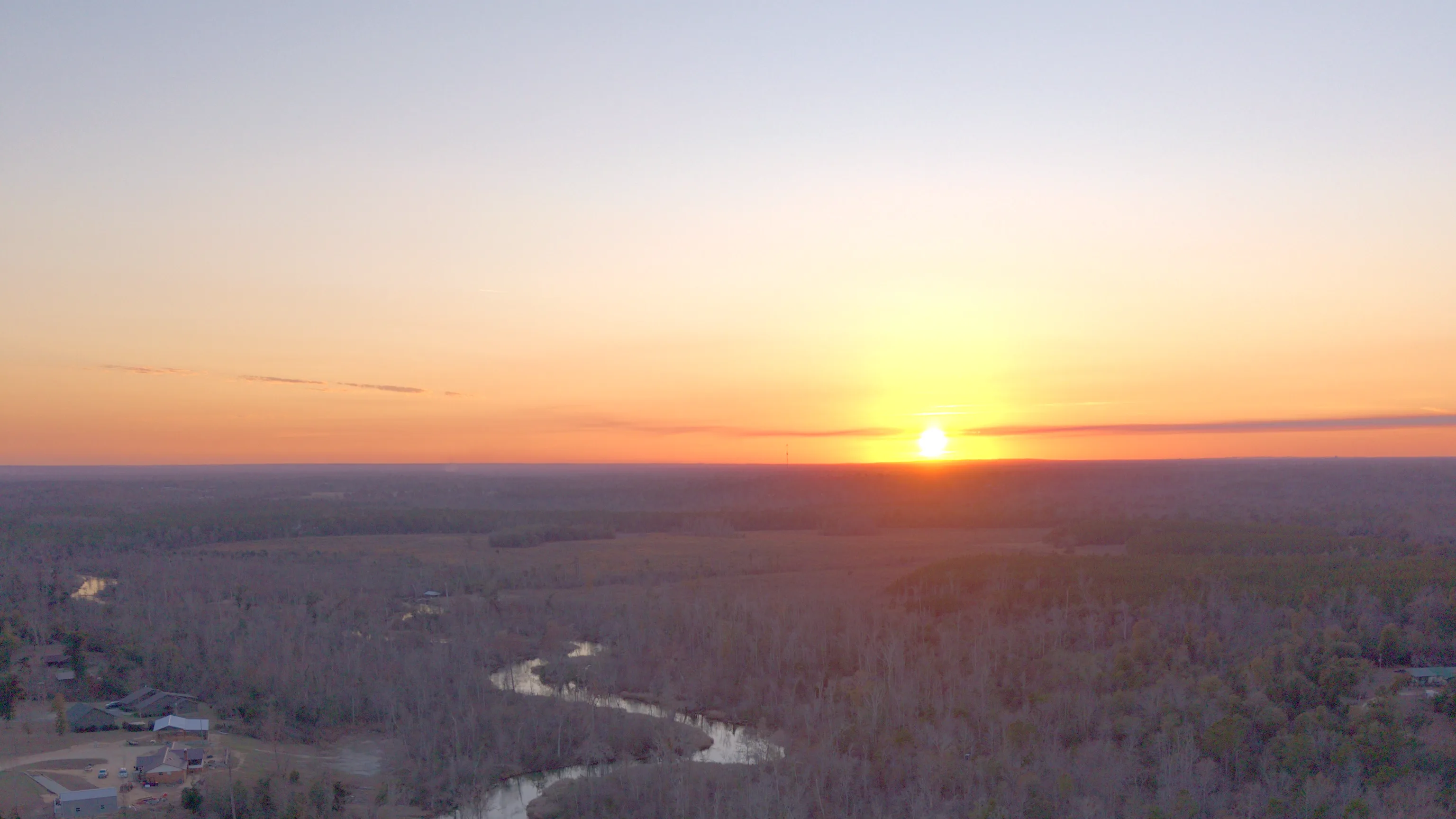
Dothan, AL
drone, real estate & video
Grand Ridge, Florida to downtown Dothan: one state line, about an hour, same time zone. We bring drone photography, real estate photography and video to Dothan, AL and the Wiregrass — an FAA Part 107 certified pilot, fully insured, fast turnaround, and travel included in every quote. We come to you.
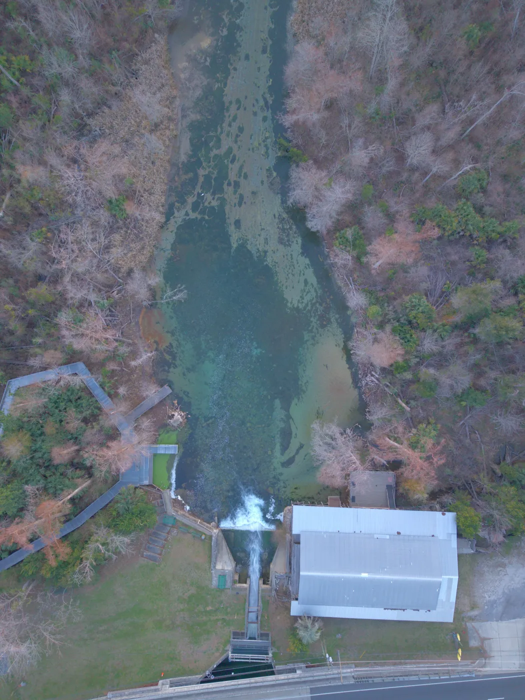
Pictured: Merritt's Mill Pond in Marianna, Jackson County FL — shot by us.
Wiregrass neighbors, one state line apart
Cross Houston County's southern line and you're in our home county. JandyLucho is based in Grand Ridge, in Jackson County, Florida, about 50 road miles from downtown Dothan — roughly an hour, depending on where in town the job is. Both sides of the line run on Central Time, so a 7 a.m. call time means the same thing to us as it does to you.
Dothan is the Houston County seat and the city the rest of the Wiregrass drives into — for the hospitals and for everything along Ross Clark Circle. We're new to Dothan, not new to the work. Same pilot, same gear, same standard as our work from Marianna down to the Gulf coast: an FAA-certified drone pilot, full insurance, and ground photo, video and aerials in a single visit. Travel is included in every quote — downtown, out in Taylor or Kinsey, or anywhere from Headland down to Cottonwood and from Ashford over to Enterprise.
Dothan real estate photography that sells the house and the lot
Buyers scroll before they drive. Our real estate photography and videography gives a Dothan listing the full set in one visit: bright interiors, clean exteriors, a twilight frame when the house earns it, walkthrough video, and aerials that show the roofline, the yard and what surrounds it. Listing photos are delivered next day, so the MLS never waits on us.
When a floor plan is worth walking through, we fly a one-take FPV fly-through tour — a single unbroken shot from the curb, through the front door and out to the back yard. It's the closest thing to a showing for a buyer who can't be there yet, including families relocating from out of state or headed to Fort Rucker. Commercial listings along Ross Clark Circle, Montgomery Highway and West Main get site-context aerials that show frontage, access and traffic flow.
Land, farm and timber aerials in peanut country
Dothan calls itself the Peanut Capital of the World, and the land around it still works — row crops, pasture, planted pine and hunting tracts across Houston, Henry and Geneva counties. Peanut ground and planted pine don't sell from the gate. A buyer driving in from out of town wants to know before the trip where the center pivots stop and the pines start, where the pond and the low ground sit, and whether the field road really reaches the back of the property.
We fly it two ways: straight down, so field edges, tree lines and water show exactly where they are, and high and oblique, so the county road, the woods and the neighboring fields sit in one frame. On request we add an approximate property-line overlay built from parcel data, labeled plainly as approximate — a marketing visual, not a survey. Sellers and brokers get stills cropped for the land-listing sites and a short flyover cut for the buyers who are already past browsing. More on our drone and aerial photography.
New construction, flown on a schedule
Houston County adds several hundred new single-family homes a year, apartment projects keep going up inside Dothan, and Headland and Enterprise are growing right alongside it. Every one of those projects has a builder, lender or owner who wants to see progress without driving out to the site.
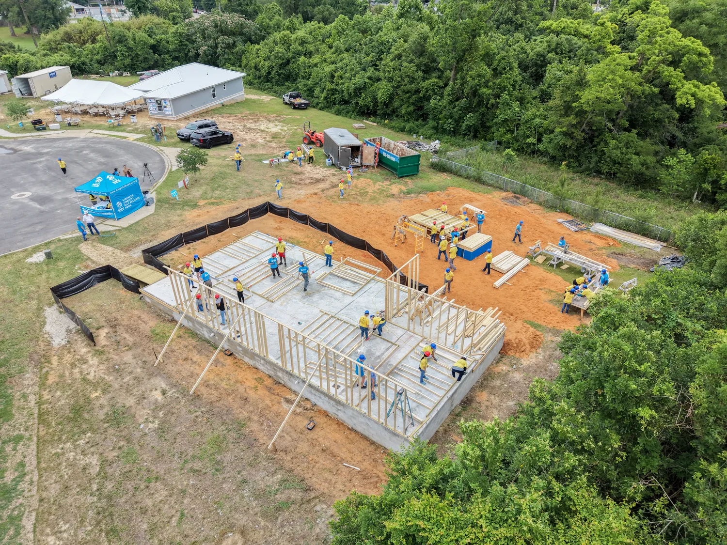
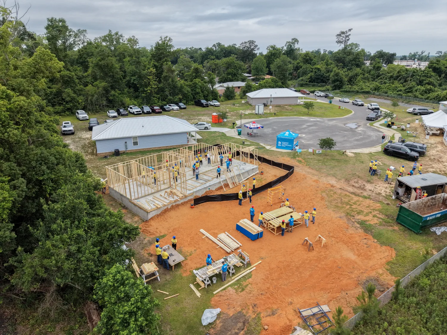
Our construction drone progress video flies the same vantage points on a set schedule — monthly or at each milestone — so slab, framing, dry-in and finish line up frame for frame. Each flight comes back as stills and a short edited update with fast turnaround, and at the end the whole sequence cuts into a film the builder can show the next client.
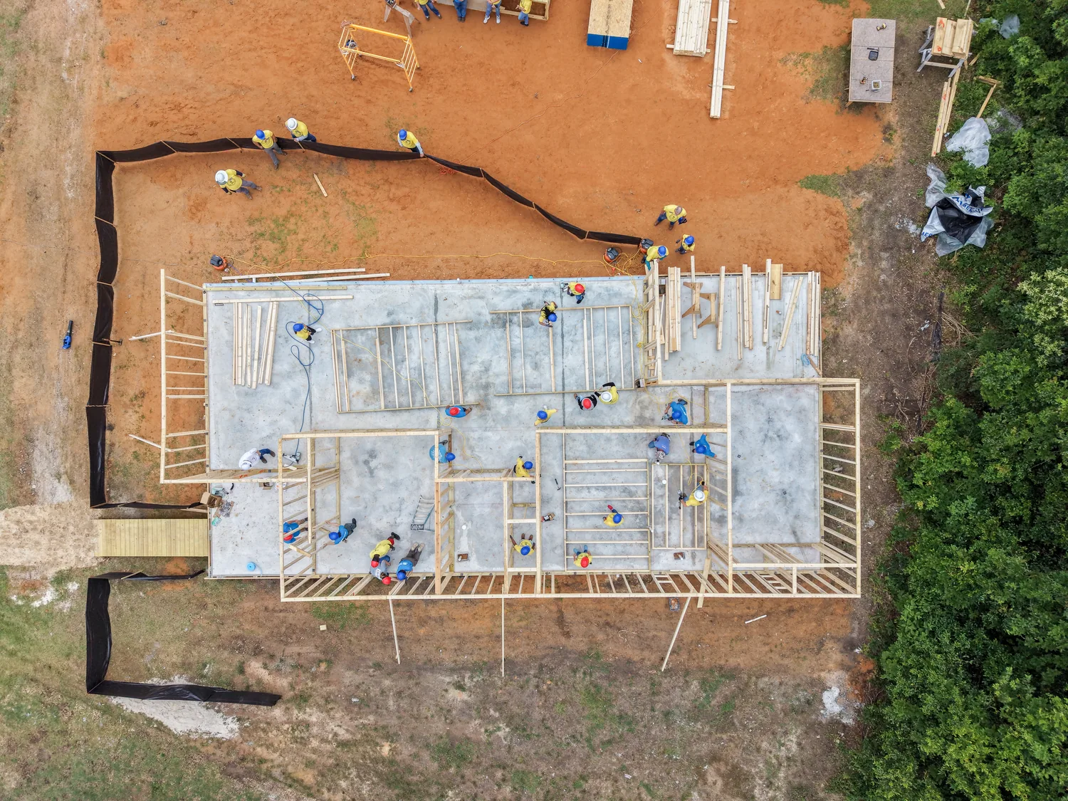
Framing from straight overhead in Marianna, Jackson County — shot by us.
Business video, events and festival season
Dothan is where the Wiregrass goes to work — the medical centers, the distribution yards, the plants, and the contractors who build for all of them. Those employers are hiring against each other, and two minutes of the real floor and the real people recruits better than one more job post. When a Dothan business needs a videographer, our video production covers brand films, recruiting and training video, campus and plant aerials, and vertical cuts for social — shot on location, edited with fast turnaround.
Then there's the calendar. Every November the National Peanut Festival takes over its fairgrounds south of town on US-231, and downtown's historic district — the Murals of the Wiregrass, the 1915 Dothan Opera House — gives venues and businesses a backdrop worth filming. We shoot event photo and video from the ground — sponsor and vendor recaps, venue promos, highlight reels — and add aerials only where Part 107 and the property owner allow. Part 107 limits flights over people, and for any gated, ticketed event we get the organizer's OK before a drone goes up.
Dothan airspace, planned before liftoff
Dothan flies differently than the coast. The FAA charts a training alert area named for the city itself — A-211, “Dothan, AL” — where Army helicopter training out of Fort Rucker (called Fort Novosel from 2023 to 2025) runs from the ground up to 5,000 feet, 6 a.m. to 10 p.m. on weekdays. It isn't restricted airspace and needs no permission, but low-flying helicopters are a real part of this sky, along with medical flights into the city's hospital helipads. A drone yields to every one of them.
Dothan Regional Airport sits inside the city limits on the northwest side. Its tower-controlled Class D airspace, a 4.7-nautical-mile ring around the field, covers much of north and northwest Dothan and reaches to within about two miles of downtown. Flights inside the Class D need FAA authorization, and Dothan Regional isn't a LAANC airport, so the request goes through FAA DroneZone — we file it well before the shoot, not the morning of. That's why we check your address against the airspace map when we quote and set the date around it. Fort Rucker's restricted area, R-2103, is a four-mile-radius circle over the post's northern ranges, about 25 miles west-northwest of downtown; the main post sits under its own Class D airspace, and we don't fly on the post.
Federal rules don't change at the state line: the same Part 107 certificate, registration and Remote ID rules apply in Dothan as in Jackson County. Alabama adds its own limits — around state prisons and, as of October 1, 2026, around ticketed events — and we plan for both. Before every job, Jandy, our FAA Part 107 certified pilot, checks the chart, NOTAMs and temporary flight restrictions. For the background, our Learning Center explains how controlled airspace and LAANC authorization work.
Same crew, both directions. US-231 runs from Dothan straight down to Panama City, and we shoot the Gulf coast too — own a beach rental in Panama City Beach, Mexico Beach or anywhere on the Florida Panhandle coast, and one call covers both properties. Closer to our base, see what we shoot in Marianna and Grand Ridge, or browse finished work in the portfolio.
Send us the address — we'll check the airspace and come back with a quote and a date. Get a Free Quote
Real Estate & Land
Next-day listing photos, walkthrough and fly-through video, and aerials that show acreage, frontage and access — from houses inside the Circle to peanut and pine tracts out in the county.
Real estate mediaDrone & Aerial
Aerial stills, video and FPV flown by an FAA Part 107 certified pilot, with the airspace checked and any FAA authorization filed before the shoot date.
Drone & aerialConstruction & Brand Video
Same-angle progress flights for builders, plus brand, recruiting and event video for Dothan businesses — edited with fast turnaround.
Video productionSouth of
the state line
Yes, we come to you, and there's no travel fee. We're based in Grand Ridge, Jackson County, Florida — about 50 road miles from downtown Dothan, roughly an hour's drive, with no time change. Travel is included in every quote, anywhere in the Dothan area.
In our portfolio. Our finished real estate, aerial and video work is in Florida, from our home county about an hour south of Dothan down to the Gulf coast. What comes north with us is the same standard: an FAA Part 107 certified pilot, full insurance with a certificate available on request, and a 5.0 rating on Google across 32 reviews.
Near Dothan Regional, yes, with FAA authorization. The airport has a control tower and sits inside the city limits, and its Class D airspace covers much of north and northwest Dothan, so we check every address when we quote and file for authorization ahead of the shoot date when it's needed. Fort Rucker is different: we don't fly on the post. Its restricted area, R-2103, is a four-mile-radius circle over the post's northern ranges, about 25 miles west-northwest of downtown, and the main post sits under its own Class D airspace. Every flight is also planned around the Army helicopter training that crosses the Wiregrass on weekdays.
Yes. Acreage is hard to show from the ground and easy to show from a few hundred feet up. We fly straight-down overhead passes that read like a map, plus wide aerials that show fields, pasture, timber, ponds, road frontage and access. On request we add an approximate property-line overlay, clearly labeled as approximate and not a survey. It works for farm and timber tracts, hunting land and homes on acreage across Houston, Henry and Geneva counties.
For agents: listing photos with next-day delivery, walkthrough and FPV fly-through video, twilight exteriors and aerials, for homes and commercial property. For businesses: brand films, recruiting and facility video, event coverage, construction progress flights and short vertical clips for social.
Call or text (305) 316-0794, or use the form on our contact page. Send the address, what the shoot is for, and when you need it. Quotes are free and travel is included, and if the address sits in controlled airspace, the date we give you already allows for the FAA authorization.
Jackson County work, shot by us
Dothan media,
delivered fast.
Get a Free Quote
★ 5.0 on Google · 32 reviews · FAA Part 107 · Insured